domingo, 24 de abril de 2016

The ice piers of McMurdo station


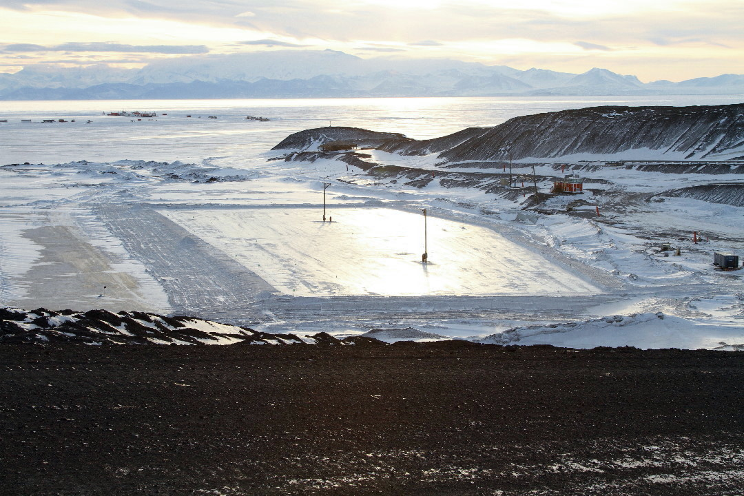
Opened in 1956, McMurdo is the most impressive of all Antarctic stations, gathering nearly 1,000 people in the summer period. The station is the logistics hub for the United States in the southern continent, but until 1965 ships “were forced to unload cargo onto the annual ice at some distance from the base”.

During Operation Deep Freeze 1965, “favorable annual ice conditions in the Ross Sea and in the approaches to McMurdo Sound permitted ice breakers to open a channel and clear a turning basin around the shore-fast ice in Winter Quarters Bay. The fast ice (…) served effectively as a wharf (…). For the first time in Deep Freeze history, all cargo ships and tankers were able to off-load directly onto Ross Island, discharging cargo onto trucks and trailers in a conventional, efficient fashion” (https://www.southpolestation.com/trivia/igy2/icewharf1973.pdf, p. 4). This natural ice wharf, named Elliott Quay (https://www.southpolestation.com/trivia/igy2/igy2.html), received a steel-and-timber reinforcement in 1972 destroyed by storm and tidal action in the same year.

Having a wharf next to the base meant that the United States Antarctic Program would not have to rely on the difficult and dangerous operations carried out over the seasonal fast ice in the nearby areas of McMurdo. However, a reliable man-made structure would have to be able to withstand the waves and small icebergs.

In 1973 the U.S. Navy built a prototype ice pier, using a method that has been perfected over time (so far, at least ten such structures have been made). Basically, it consists of an ice block, large enough to last for three to five summers before it is discarded.


The ice pier in January 2015


The construction process starts in early winter, when sea ice is approximately half a meter thick, strong enough to support the weight of the required equipment. An area of about 100 x 45 m (https://www.epa.gov/ocean-dumping/ocean-disposal-man-made-ice-piers) is selected and its surface is scraped free of snow – the cleared snow will be used “to build berms along the edge of what will become the pier. The berms are frozen to create a dam that will trap water on top of the pier as it is flooded and thickened” (https://antarcticsun.usap.gov/AntarcticSun/features/documents/icepier.pdf). Seawater pumping is done in successive repetitions so that each layer of water solidifies and increases the height of the block:


When the ice pier is between two and three meters thick, a layer of gravel will be spread evenly, in order to protect it from the growing heat and also to provide a non-slip working surface:


By the time the icebreakers arrive, the surrounding sea ice will have melted and the pier, which is a floating block, will need to be connected to land by a bridge. There has to be a moat between the ice pier and the land, so that the structure is deep enough into the water. A warming hut (which will serve as an operations center), wooden-utility poles and other equipment necessary for the operation of the structure are installed:


If the construction has been done successfully, the pier will already be sturdy enough not to melt for some seasons. By the end of each summer, the National Science Foundation decides whether the ice pier will be maintained for next year (in that case, a winter maintenance operation is performed) or if it is not safe to use it. If it is not appropriate to keep it, the structure is then towed out to sea. The worn-out ice pier shown in the figure below, on the right (beyond the new one), could no longer be used:


Weather in Antarctica is unpredictable, and severe storms can occur. The ice pier can be seriously affected:


In the summer of 2010-11, the ice pier built in 2010 (the same of the photo above and the newest one in the picture before that) ended up breaking loose and drifted away. It was found in October 2011, in the middle of sea ice and miles away from the base (https://antarcticsun.usap.gov/features/2548/):


In other situations, the ice pier has collapsed (the two photos below are from the 1983 summer season):


The high temperatures during the winter of 2011 did not allow the construction of an ice pier sufficiently thick (https://www.southpolestation.com/mcm/1112/shipping2.html). Thus, by early 2012 the U.S. Army 331st Transportation Company assembled a Modular Causeway System (MCS) to replace to ice pier:


Once the annual supply was completed, the MCS was dismantled and, during the winter of 2012, the construction of a new ice pier took place. The operation was successful, but this ice pier only lasted until February 2014 (http://bottom-of-the-earth.blogspot.com/2014/02/vessel.html). A new ice pier was built in 2015 (https://www.msc.navy.mil/sealift/2015/Winter/mcmurdo.htm), but we do not know how long it lasted. For summer 2019-20, the Modular Causeway System was once again necessary, as the unusually warm 2019 winter prevented the construction of the ice pier (https://twitter.com/Antarctic_Infra/status/1223186741454155776).


The video below (available at https://www.youtube.com/watch?v=dUCPFfirE_U&feature=youtu.be&t=11) shows operations on the ice pier in time-lapse. After 1:16, the interesting and intense unloading works of the cargo ship MV Ocean Giant can be seen:


_____________________________________


Photo 1: https://www.jeffreydonenfeld.com/blog/2015/01/ship-operations-at-the-worlds-southernmost-seaport/;

Photos 2 and 3: ?;

Photo 4: bigblueglobe.blogspot.com/2010/11/just-add-dirt.html;

Photos 5 to 9: ?;

Photos 10 to 12: bigblueglobe.blogspot.com/2011/10/ice-piers-been-found.html;

Photos 13 and 14: Randy C. Bunney;

Photos 15 to 20:  331 Transportation Company (Causeway) https://www.facebook.com/331CauswayCo.


sábado, 23 de abril de 2016

Muelles de hielo de la estación McMurdo


Fundada en 1956, McMurdo es la más impresionante de todas las estaciones antárticas, llegando a concentrar cerca de 1.000 personas en el período de verano. La base es el centro logístico de los EUA en el continente austral, pero hasta el 1965 los buques tenian que descargar sobre el hielo anual, a una cierta distancia del complejo.

Durante la Operación Deep Freeze 1965, las condiciones anuales favorables de hielo en el Mar de Ross y en el estrecho de McMurdo permitieron que los rompehielos abrieran un canal en la bahía Winter Quarters. El hielo fijo sirvió efectivamente como muelle, y por primera vez en la historia de Deep Freeze, todos los buques de carga y buques cisterna pudieron descargar directamente en la isla de Ross, descargando carga en camiones y remolques de manera convencional y eficiente (https://www.southpolestation.com/trivia/igy2/icewharf1973.pdf, p. 4). Ese muelle de hielo natural, llamado Elliott Quay (https://www.southpolestation.com/trivia/igy2/igy2.html) recibió un refuerzo de acero y madera en 1972, destruido por la acción de tormentas y mareas en el mismo año.

Tener un muelle junto a la base significaba que el United States Antarctic Program no tendría que depender de las operaciones difíciles y peligrosas que se realizaban sobre el hielo fijo estacional en las áreas cercanas a McMurdo. Sin embargo, una estructura artificial confiable tendría que ser capaz de resistir las olas y los pequeños icebergs.

En 1973, la U.S. Navy construyó un prototipo de muelle de hielo, utilizando un método que se ha perfeccionado con el tiempo (hasta ahora, se han confeccionado al menos diez de esas estructuras). Básicamente, consiste en un bloque de hielo, lo suficientemente grande como para durar de tres a cinco veranos antes de que se descarte.


Muelle de hielo en enero de 2015


El proceso de construcción comienza a principios  del invierno, cuando el hielo marino tiene aproximadamente medio metro de espesor y es lo suficientemente fuerte como para soportar el peso del equipo requerido. Se selecciona un área de aproximadamente 100 x 45 m (https://www.epa.gov/ocean-dumping/ocean-disposal-man-made-ice-piers) y de ella se retira toda la nieve, la cual va a ser utilizada para aislar el agua que será bombeado para espesar el muelle 
(https://antarcticsun.usap.gov/AntarcticSun/features/documents/icepier.pdf). El bombeo de agua de mar se hace en repeticiones sucesivas, de manera que cada capa de agua se solidifique y aumente la altura del bloque:


Cuando el bloque ya tiene entre dos y tres metros de espesor, y se le coloca una capa uniforme de grava, que lo va a proteger del creciente calor y también proporciona fricción para la seguridad de las operaciones:


Para cuando lleguen los rompehielos, el hielo del mar alrededor se habrá derretido y el muelle, que es un bloque flotante, deberá estar conectado a tierra por un puenteTiene que haber un foso entre el muelle de hielo y la tierra, de modo que la estructura sea en agua lo suficientemente profunda. Se le instala una cabina climatizada (que servirá como centro de operaciones), postes y otros equipos necesarios para el funcionamiento de la estructura:


Si la construcción se ha realizado correctamente, el muelle ya va a estar lo suficientemente intacto para no fundirse por algunas temporadas. Al final de cada verano, la NSF (National Science Foundation) decide si el muelle de hielo se mantendrá para el próximo año (y, en este caso, se realiza una operación de refuerzo durante el invierno) o si no es seguro usarlo. Si no es apropiado mantenerlo, el muelle de hielo es entonces remolcado hacia fuera de la bahía. El muelle desgastado que aparece en la figura de abajo, a la derecha (allá de donde está el rompehielos Nathaniel B. Palmer) no estaba en condiciones de uso:


El clima en la Antártida es imprevisible, y pueden ocurrir tormentas severas. El muelle de hielo puede verse seriamente afectado:


En el verano de 2010-11, el muelle de hielo construido en 2010 (el mismo que en la foto de arriba) terminó rompiendo los enlaces y se fué a la deriva. Ha sido encontrado en octubre de 2011, en medio del hielo marino y a kilómetros de distancia de la base  (https://antarcticsun.usap.gov/features/2548/):


En otras situaciones, se ha producido el colapso del muelle de hielo (las dos fotos de abajo son de la temporada de verano de 1983):


Las altas temperaturas del invierno de 2011 no permitiran la construcción de un muelle suficientementemente grueso (https://www.southpolestation.com/mcm/1112/shipping2.html). Por eso, a principios de 2012 la 331a Compañía de Transporte del U.S. Army ensambló un muelle modular de acero (Modular Causeway SystemMCS) para reemplazar al muelle de hielo:


Terminado el suministro anual, el MCS fue desmantelado y, durante el invierno de 2012, se inició la construcción de un nuevo muelle de hielo. 
La operación fue exitosa, pero ese muelle de hielo solo duró hasta febrero de 2014 (http://bottom-of-the-earth.blogspot.com/2014/02/vessel.html). En 2015 se construyó un otro muelle de hielo (https://www.msc.navy.mil/sealift/2015/Winter/mcmurdo.htm), pero no sabemos cuanto tiempo resistió. Para el verano de 2019-20, se requerirá nuevamente el Modular Causeway System, ya que el invierno inusualmente cálido de 2019 impidió la construcción del muelle de hielo (http://southpolestation.com/news/news.html?imz_s=b7ajejq5oj6p8235pbfemqar76).


El video de arriba muestra un poco de las operaciones del muelle de hielo en time-lapse. A partir de 1:16, se ve la interesante e intensa faena de descarga del buque Ocean Giant.


_____________________________________


Foto 1: https://www.jeffreydonenfeld.com/blog/2015/01/ship-operations-at-the-worlds-southernmost-seaport/;

Fotos 2 and 3: ?;

Foto 4: bigblueglobe.blogspot.com/2010/11/just-add-dirt.html;

Fotos 5 to 9: ?;

Fotos 10 to 12: bigblueglobe.blogspot.com/2011/10/ice-piers-been-found.html;

Fotos 13 and 14: Randy C. Bunney;


Fotos 15 to 20:  331 Transportation Company (Causeway) – https://www.facebook.com/331CauswayCo.


Portos de Gelo (Iceports/Puertos de barrera)


Em locais como a Terra de Coats e a Terra da Rainha Maud são raros os afloramentos rochosos, especialmente na costa –algumas estações, inclusive, não são construídas sobre o solo, mas repousam sobre as plataformas de gelo ou sobre o manto de gelo. Em tal situação, o uso de portos de gelo é central para a logística de abastecimento. O presente post trata dos locais que servem às estações Halley VI, Neumayer II, SANAE IV e Princesa Isabel (In places like Coats Land and Queen Maud Land rocky outcrops are rare, especially on the coast – some stations are not even built in the rock, but they rest above ice shelves or ice sheet. In such situation, the use of ice ports is a keystone to supply logistics. This post shows the sites that serve to Halley VI, Neumayer III, SANAE IV and Princess Elisabeth stations  / En lugares como la Tierra de Coats y en la Tierra de la Reina Maud los afloramientos rocosos son raros, especialmente en la costa – incluso algunas estaciones antárticas no están ancladas en la roca, pero reposan encima de las barreras de hielo o del manto de hielo. En tal situación, el uso de puertos de barrera es clave para la logística de suministro. El presente post trata de los sitios que sirven a las estaciones Halley VI, Neumayer III, SANAE IV y Princesa Isabel)].


[Terra de Coats e Terra da Rainha Maud clique para iniciar exibição ou use o segundo botão do mouse para abrir a imagem (Coats Land and Queen Maud Land click to exhibit or use the secondary mouse button to open the image in a new window / Tierra de Coats y Tierra de la Reina Maud) haga clic para exhibir o utilice el botón secundario del ratón para abrir la imagen en una ventana nueva)]

Diferentemente do que ocorre nos lugares onde se encontram os cais e píeres referidos no post anterior, no manto e nas plataformas de gelo se produz acumulação positiva de neve –a qual, com o tempo, termina por cobrir todas as estruturas ali construídas. Na plataforma Brunt, onde se encontra a estação britânica Halley, a acumulação anual de neve chega a 1,2 m e, por essa razão, em 2012 foi inaugurada uma nova base sobre esquis, desenhada para ser totalmente deslocada de um lugar para outro (Unlike what happens to the wharves and piers mentioned in the previous post, there is net snow accumulation over time on the ice sheet and on the ice shelves, and every structure built there eventually ends covered in snow. On the Brunt Ice Shelf, where Halley station is located, annual snow accumulation reaches 1.2 m, and for that reason a new base, mounted on skis and designed to be completely moved from one place to another, was inaugurated in 2012 / A diferencia de lo que ocurre en los lugares donde se encuentran los muelles referidos en el post anterior, en el manto y en las barreras de hielo se produce acumulación positiva de nieve –la cual, con el tiempo, termina por cubrir todas las estructuras construidas allí. En la barrera de hielo Brunt, donde se encuentra la estación británica Halley, la acumulación anual de nieve llega a 1,2 m, y, por esta razón, en 2012 se construyó una nueva base en esquís, diseñada para ser totalmente desplazada de un lugar a otro).Essa movimentação foi realizada ao menos uma vez, mas em fins de 2015 chegou a notícia de que a plataforma pode se romper, deixando a nova estação isolada do continente e condenada a afundar no mar. Portanto, um deslocamento maior está previsto, visando a manter a base em local mais seguro (That movement was carried out at least once before, but by the end of 2015 word came that the ice shelf could break, leaving the new station isolated from the mainland and doomed to sink into the sea. Therefore, a greater displacement is planned, in order to keep the base in a safer place / Tal movimiento se ha realizado al menos una vez, pero a finales de 2015 llegó la noticia de que la barrera Brunt puede romperse, dejando la nueva estación aislada del continente y condenada a hundirse en el mar. Por lo tanto, un mayor desplazamiento está previsto, con el fin de mantener la base en lugar más seguro).


Essa dinâmica das plataformas de gelo se deve ao fato de que elas estão em contínuo movimento, porque ganham massa com a acumulação de gelo que flui do manto, e perdem massa com a liberação de icebergs e com o derretimento do fundo pela água do mar. Em seu sítio atual, Halley VI é servida por vários portos de gelo, utilizados de acordo com as condições do mar de Weddel no momento do abastecimento (That dynamics of the ice shelves is due to the fact that they are in continuous movement, because they gain mass with the accumulation of ice flowing from the ice sheet, and lose mass with the liberation of icebergs and the melting of the bottom by the sea water. At its current site, Halley VI is served by several ice ports, used according to Weddel Sea conditions at the time of resupply / Esa dinámica de las barreras de hielo se debe a que están en continuo movimiento, porque ganan masa con la acumulación de hielo que fluye del manto, y pierden masa con la liberación de icebergs y el derretimiento del fondo por el agua de mar. En su sitio actual, Halley VI es servida por varios puertos de barrera, que se utilizan de acuerdo con las condiciones del mar de Weddell en el momento del suministro).


{Plataforma de gelo Brunt, estação Halley VI (Reino Unido) e seus portos de gelo [Brunt Ice Shelf, Halley VI station (UK) and its iceports Barrera de hielo Brunt, estación Halley VI (RUN) y sus puertos de barrera]}


[porto de gelo Creek 3, nos Gin Bottle Creeks (iceport Creek 3, on the Gin Bottle Creeks / puerto de barrera Creek 3, en los Gin Bottle Creeks)]


[porto de gelo Creek 4, nos Gin Bottle Creeks (iceport Creek 4, on the Gin Bottle Creeks / puerto de barrera Creek 4, en los Gin Bottle Creeks)]


[porto de gelo Creek 4 (iceport Creek 4 / puerto de barrera Creek 4)]


[caminho até Halley a partir do porto de gelo Creek 4 (route to Halley from the iceport Creek 4 / camino a Halley VI desde el puerto de barrera Creek 4)]


[porto de gelo N9 e o caminho até Halley (iceport N9 and the route to Halley / puerto de barrera N9 y la ruta hacia Halley VI)]


{Localização dos portos de gelo (buktas) nas plataformas Ekström e Fimbul. Atendem às estações Neumayer III (Alemanha) e SANAE IV (África do Sul) [Location of iceports (buktas) at Ekström and Fimbul Ice Shelves. They serve to Neumayer III (Germany) and SANAE IV (South Africa) stations / Ubicación de los puerto de barrera (buktas) en las plataformas Ekström y Fimbul. Sirven las estaciones Neumayer III (Alemania) y SANAE IV Sudáfrica)]}


[Atka Bukta – atualmente é usada por Alemanha e África do Sul. Na foto, o quebra-gelos alemão Polarstern ( currently used by Germany and South Africa. In the photo, the German icebreaker Polarstern / – actualmente utilizado por Alemania y Sudáfrica. En la foto, el rompehielos alemán Polarstern)]


(Atka Bukta – Polarstern)


(Atka Bukta – Polarstern)


[Penguin Bukta – utilizado pela África do Sul. Na foto, o antigo navio SA Agulhas (used by South Africa. In the picture, the old SA Agulhas / – usado por Sudáfrica. En la image, el viejo buque SA Agulhas)]


[Penguin Bukta – SA Agulhas]


{Plataforma de gelo Rei Balduíno, estação Princesa Isabel (Bélgica) e seus portos de gelo [King Baudouin Ice Shelf, Princess Elisabeth station (Belgium) and its iceports/Barrera de hielo Rey Balduino, estación Princesa Isabel (Bélgica) y sus puerto de barrera]}


{porto de gelo Crown Bay – na imagem se vê o quebra-gelos japonês Shirase, que integra a DROMSHIP (Droning Maud Land Ship Network), rede de abastecimento naval mantida em cooperação pelos países que possuem estações na região [iceport Crown Bay – the japanese icebreaker Shirase is part of DROMSHIP (Droning Maud Land Ship Network), a joint maritime logistics network held by countries with research stations in the region  puerto de barrera Crown Bay  en la imagen, se ve el rompehielos japones Shirase, que integra la DROMSHIP (Dronning Maud Land Ship Network), red de abastecimiento naval mantenida en cooperación por los países que poseen estaciones en la región]}


[porto de gelo Dog's Head – o navio Mary Arctica é um cargueiro fretado que também atende à DROMSHIP (iceport Dog's Head  Mary Arctica is a chartered cargo freighter that also operates within the DROMSHIP puerto de barrera Dog's Head – Mary Arctica es un buque de carga fletado que también integra la DROMSHIP)]


[porto de gelo Breid Bay (iceport Breid Bay/puerto de barrera Breid Bay)]